Mid-summer, it’s time for a big walk: to exchange construction sites and computers for a bigger, more tangible perspective on what it is we’re working on here. Conceptualizing 650,000 acres stymies most of us. We talk about Yosemite as a parallel for this project, in terms of both scale and vision, but other comparisons also help visualize its scope. 650,000 acres is about the size of the state of Rhode Island and larger the combined areas of the New York City, Los Angeles, and San Francisco. Patagonia National Park will be 110% the size of Chile’s Torres del Paine. It would be among the ten biggest parks in the contiguous US, and is over twice the size of both Grand Teton and Rocky Mountain National Parks.
Enough trivia fodder. Better than searching for paper comparisons is experiencing the vast-and uncommon-potential for exploring the unknown, still within the future park’s boundaries. So last week, Ana Brown, Volunteer Program Leader this season, and I (Nadine) pulled out the maps to scheme up a trip in the mountains of Jeinimeni National Reserve, the northern part of the future park.
Starting off up old mining road running from Lago General Carrera to a high plateau in the Furioso sector saved us a long uphill bushwack. As we unloaded from the truck, two things caught our attention: the scope of the mining operation and the wind. Mandalay, an Australian mining company, built innumerable roads cutting across this area, which lies just outside of Conservacion Patagonica’s property, simply to assess its potential mineral wealth. Despite never finding much of anything worth mining, they made a mess and still have employees on site overseeing the problem-ridden shutdown of the operation. The orange-jumpsuited man we saw invited us into his metal container office, where he expressed his surprise at two girls out hiking and we stole a peek at the various plans posted on the wall.
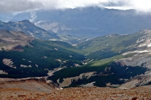
Then we stepped outside, put on our packs, and proceeded to get blown over. Literally. The ripping wind brought clouds in and out; when they momentarily cleared, familiar landmarks—Tamango/ Tamanguito, Lago Gutierrez, Rio Furioso—emerged, at new angles.
We followed the perplexingly interminable mining road for a ways before dropping down off the plateau into the valley to the northwest, Valle Los Hormiguos. Despite dreading forest-walking from high up, we found the going easy below tree line. A livestock trail ran alongside the river; we had no idea who would keep cows up here, but saw plenty of fresh evidence of both cattle and horses. When we came to the top of the valley, we crossed over into Valle Los Maitenes, where a bigger, brown river runs through lenga, coigue and nirre forests. The composition and character of the forests changed often, from stretches of enormous old trees with little understory around them to patches of dense, shrubby trees with no room to walk in between.
Several kilometers up the valley, we encountered our first problem. The river became a series of tall waterfalls, twisting back into a canyon, with steep rocky hillsides on either side. We cursed the large contour intervals on our map, and set about crawling and clawing our way up and around. Rain decided to make our lives more pleasant. We spent the night in a flattish spot in the soggy, rocky forest, and the next morning continued the slog until we saw a wonderfully wide, gravelly riverbed stretch up to the high pass into Valle Hermoso.
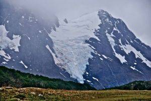
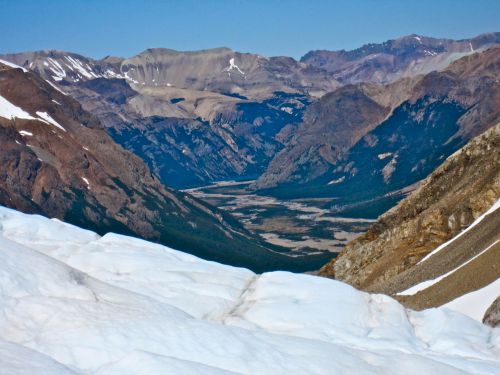
We still had no idea if we could make it over this pass: as far as we could find out, no one had come this way before. So we picked our way up scree slopes and across swollen rivers, looking up at the steep peaks and big blue glaciers with some trepidation. But good old Google Earth had served us well, and we trotted up and over the pass no problem, only photo breaks slowing us down.
Lunching by the shores of the lake at the top of Valle Hermoso, we marveled at the impressively different face of the future park we were looking at. After spending months in the Chacabuco Valley, we can deliver lengthy dispositions on the fine points of guanaco mating behavior or the removal of pimpenellas and other sharp grassland plants from one’s socks. Hikes through the lush southern beech forests, with their marvelous array of delicate ground cover plants, give a taste of what this much-discussed “diversity of ecosystems” means. But walking a continuous loop through several forest types, grasslands, bogs, rivers, and high, glaciated mountain areas, brought this concept to life in a deeper way. In a fairly short span of time, we watched the plant and animal life, topography, and climate undergo numerous transformations. Watching waterfalls drain from glaciers, pouring over polished granite, felt worlds away from grassy-guanaco-land.
From there, we cruised down the appropriately-named Valle Hermoso, a wide gravel valley leading towards Lago Jeinimeni. Several kilometers down, we took a right to come over a low pass into Aviles Valley, the long north-south valley that would take us back to the Chacabuco Valley. Once we found a horse trail running down the east side of the valley, we made quick progress, crossing between the open forests and gravelly riverbed. That night, we slept on a grassy plateau above the river, and ate dinner as the almost-full moon rose.
The next morning, we found a good spot to cross the river, still high from all the rain, and continued down through the canyony sections of Aviles onto the flat grassy plateaus, and then down to the Chacabuco Valley. All in all, a fantastic taste of what this park will have to offer that makes us psyched to get out and see more.


I want to come on your next adventure, please.